
HOME
> Disaster and Safety Management> Best Practices> Public Safety Map Service
Public Safety Map Service
Public Safety Information Service
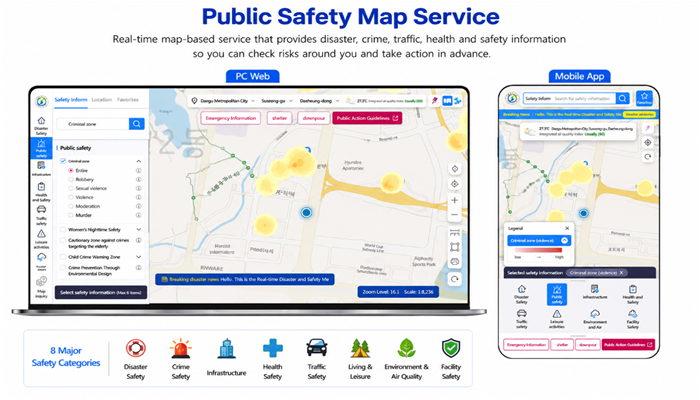
The Public Safety Information Serviceis a national platform that provides map-based information on accidents, disasters, and potential safety risks.
Citizens can use the service to identify risks in their neighborhoods and take appropriate safety precautions.
Key Services
Public Safety Maps
Provides 130 map services across eight major safety categories
- Disaster Safety
- Crime Safety
- Infrastructure
- Health Safety
- Traffic Safety
- Living & Leisure
- Environment & Air Quality
- Facility Safety
Available information includes flood and urban inundation risk areas, earthquake occurrence history, crime warning zones, nighttime safety routes, traffic accident-prone areas, hospitals, pharmacies, AED locations, CCTV cameras, public facilities, and facility safety ratings.
Public Safety Map Service
- Ministry of the Interior and Safety
+82-44-205-4506
